Page Bridge Missouri River Crossing
The Creve Coeur Park Connector offers a great way to get to and from the Katy Trail from St Louis County. This 3.6 mile long bike lane enables cyclists to use the Page Avenue /
364 bridge to cross the Missouri River, totally separate from automotive traffic. On the west end, it connects to the Katy Trail at mile 42.8, just south
of the Family Arena. On the east end, it connects to the Creve Coeur Park trails
at the park's southwest corner. It mostly runs parallel with hwy 364 (Page Ave).
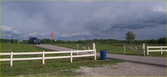
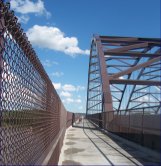 Cars are on the other side of the fence on the right
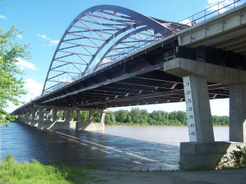 The view from the Trail
Some Mileage Measurements:
-
3.3 St Charles trailhead to Page Ave Bridge
-
0.85 Family Arena to Page Ave Bridge
-
0.25 Katy Trail to bridge parking lot (up hill - see photo below)
-
0.6 Length of Missouri River Bridge
-
3.6 St Charles parking lot to end of ramp at Creve Coeur Mill<
-
4.7 St Charles parking lot to Creve Coeur Park soccer field parking lot
There's a parking lot with nearly 100 slots at the St Charles end of the bridge (photo below).
But it's at bridge level, high above the Katy Trail. A paved ramp leads down to the trail.
If you park there, save some energy to climb the ramp back up to the parking lot when you return.
It's a 1/4 mile of climbing: the switchbacks can be seen through the bridge's
chain-link fence in the photo at left. The Creve Coeur side involves a little bit of climbing,
but it's a shorter ramp and a lower degree of incline than the ramp to the Katy Trail.
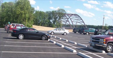
Trail Parking on St Charles side
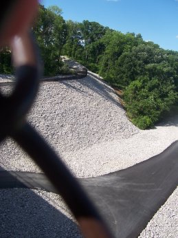
Ramp from Katy Trail up to the bridge
Getting There By Car - St Charles Parking Lot
Take 270 to the Page/364 exit, heading west. Go 6 miles to exit 14, Upper Bottom Road / Arena Parkway.
Go right (north), and take an immediate right on Hemsath. Follow Hemsath for 0.3 mile, and take the right turn
into the parking lot just after Hemsath curves left.
Creve Coeur Park is a jewel of the St Louis County Parks. Several miles of flat trails encircle a
sparkling lake. The lake is often filled with sailboats, kayakers, and scullers. Trails on the southwest end of
the lake are mostly wooded. There's a small playground on the south end of the lake, near the dripping springs where,
according to legend, a Native American maiden with a broken heart ("creve coeur" in French) gave the lake its name.
Here is the St. Louis County Parks Department's
website for Creve Coeur Park.
Getting There By Car - Creve Coeur Park
Take 270 to the Page/364 exit, heading west. Once you're on Page, the second exit is Maryland Heights Parkway.
Exit here and go north. The second stop light is Creve Coeur Mill Road; take a right. Just after crossing over
the railroad tracks, there is a park entrance on the left. Proceed through the gates and up the hill. You will see
several parking lots next to the soccer fields (here's the location on
Google Maps).
There's also parking on the other side of the lake; to get there,
follow Maryland Heights Parkway to Marine and go right (here's the location for that parking on
Google Maps).
 Turn here to park at the soccer fields
To get to the Katy Trail Connector from the soccer field parking lot, ride toward the lake until you reach the trail
that runs alongside the lake (location of portable restroom). Take a right (south) and in less than a mile you'll
cross under the massive Page Avenue extension bridge. Shortly after crossing under Page, there is a ramp
heading up toward Page, which is the connector.