Using the Kirkwood MO Amtrak Station for the Katy Trail
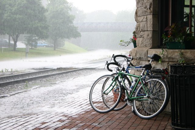 Photo: Kelly Palmer
What's the best route from Kirkwood Amtrak Station (in St Louis County) to the Katy Trail?
To cross the Missouri River, your best bet is to use the Page/364 bridge.
There's also a crossing at highway 64/40, but not as clear of a route from there to Kirkwood.
If you opt for a shuttle instead, you might want to try
Show Me MO Tours Shuttle.
I'm guessing that Kirkwood-to-St Charles is in the neighborhood of a 20-mile ride (this is just my "gut feeling" estimate, so expect some variance).
Route Suggestion 1
The first suggestion was taken from the American Discovery Trail’s official route, so presumably it has been well tested.
Kirkwood --> 370 (Discovery Bridge):
North on Kirkwood Rd. 2 blocks to Adams (turn left/west)
[see note in blue below]
Adams through Sugar Creek Valley (turns into Ballas after 2 miles, and curves north)
Continue on Ballas across Dougherty Ferry (at 2.4 miles), across Manchester (at 3.8 miles), to Ladue Rd (at 7.4 miles).
Turn left/west on Ladue Rd.
Ladue Rd 2.1 miles west to Mason N. Turn right/north at N Mason. (there is a shortcut here at Chasselle
Lane - turn right shortly before Mason, after 1.7 miles on Ladue - takes you to Mason
Mason Rd 2.1 miles (or 1.8 miles if you used Chasselle) to Olive
Left/west on Olive, 0.5 mile to Fee Fee
Right/north on Fee Fee, 1.1 miles to Bennington Place
Left/north on Bennington, 0.5 mile to Basston Dr.
Left on Basston, 0.2 mile to Marine
Left/west on Marine 2.4 miles past Creve Coeur Park
to Maryland Heights expressway
Right on Maryland Heights Expressway - after about 1.5 miles it becomes Earth City Expressway (has shoulders, but not for the faint of heart.)
Earth City expressway to St. Charles Rock Road (1.7 miles after passing under I-70)
Left/west on St. Charles Rock Road, 0.7 mile to Missouri Bottom Road
Right/north on Missouri Bottom Road 1.1 miles to MO 370 - turn left - cross Discovery Bridge - there
is a bike trail exit right past the bridge span which will take you down to
the MRT. (the bridge is not for the faint of heart also)
Kirkwood to the Page Extension Bridge: (same route as above until Creve Coeur Park)
North on Kirkwood Rd. to Adams (turn left)
[see note in blue below]
Adams through Sugar Creek Valley (turns into Ballas)past Manchester to Ladue
(turn left)
Ladue west to Mason N. (turn right) (there is a shortcut here at Chasselle
Lane - turn right shortly before Mason - takes you to Mason)
Mason to Olive - turn left for short (.4 mile) run to Fee Fee - turn right
on Fee Fee
Fee Fee to Bennington Place - turn left
Bennington to Basston Dr. - turn left
Basston to Marine - turn left
Follow Marine to Creve Coeur Park
Use the Creve Coeur Park trails:
get on Bike/Walking trail and follow around the north
side of lake and then follow south along the west side of the lake. Skirt
right around the west side of ball fields - follow the trail straight and
this will lead you to the connector to the bike path over the Page
Extension Bridge.
One suggested revision to the above directions: The train station is on Argonne Road,
between Kirkwood Road on the east and Clay Ave on the west. It would be better to take Clay north to Adams,
rather than Kirkwood Road, because Kirkwood Road is very busy and has no good shoulder or bike lane. Clay
and other streets to the west are residential and have much lighter traffic.
Route Suggestion 2
Note: the Olive/270 construction mentioned below is finally completed,
and they even included a striped bike lane for part of that section of Olive.
No way I'd be on Lindbergh. I'd head west on Adams to where it turns into
Ballas, then north on Ballas 'til it ends at Olive.
Once at Olive, when they finish the lovely construction at Olive & 270,
head west on Olive to Ross Rd and turn right. This will take you all the
way to Bennington, which has an entrance to Page west (this is right near
the start/finish for the TT that was held out there during the winter).
As an alternative 'til Olive/270 is complete, cross Olive at Ballas. I
don't know the name of the street, but it eventually dumps onto Craig, I
believe. From there, turn left, and it will get you to Westport, and turn
into Marine Drive. After passing under 270 and climbing a short hill, you
can hang a left on Bennington and get back to Benngington and Page. Then
it's the same as above.
I'd vote for Geyer->....->Craig->Westport->Marine-> etc. Ballas til
Clayton is OK, but north of Ladue on Ballas there is 2-lane high speed
traffic, no wide lane, no shoulder, and a high steep curb. I ride on
busy roads regularly, even Lindbergh, but not THAT one. The Geyer route
is less hilly too; I'm not a hill fan.
I haven't ridden the Mosley->Craig short section of Olive, although I
drive it now and then
Route Suggestion 3
Adams west of Geyer is a very scenic ride, but it lets you out on
Ballas, which, while quite efficient, is perhaps too heavily traveled for
some tastes.
A good alternative would be Geyer to Clayton to Spoede to
Ladue to Moseley to Olive to Craig. From the Amtrak station, west on
Argonne to Clay to either Adams or Essex to Geyer. Craig (which, if you
are taking Ballas, can be accessed by simply crossing Olive and following
it around behind the Koman office park) will take you to Page, but from
there how to actually get on the extension is a bit of a mystery to me.
Route Suggestion 4
Thanks to Paul for posting this route in the Trail Comment Forum.
This route is in the opposite direction of the above routes, from Creve Coeur Park to Kirkwood
(again, here's the link if you need details on the Creve Coeur Park Connector Trail
and where it connects to the Katy).
From the Page Bridge and Creve Coeur Park Connector Trail, I took the following
roads:
SE on Marine Ave.
Straight on Westport Plaza Dr.
Straight on Craig Rd.
Left on Olive Blvd.
Right on Mosley Rd.
Left on Ladue Rd.
Right on Spoede Rd.
Right on Clayton Rd.
Left on Geyer Rd.
Left on Argonne Rd.
Except for the long, steep hill on Marine Ave., this
turned out to be a pleasant, fairly quiet ride. In addition to the hill, Marine
was pretty narrow, twisty, and busy. Much to my surprise, no one honked at us
and most vehicles passed in a courteous fashion. However, I would only recommend
this route to very experienced riders.
Route Suggestion 5
Thanks to Wes Ridgeway of St Louis for sharing his route from
Grant's Trail in southwest St Louis County to the Katy Trail.
If coming from the Kirkwood Amtrak station, you just head a few blocks north to Adams and take a left,
and Adams eventually leads to Ballas (after a nice ride through the lovely Sugar Creek area).
My route from Union Road to Frontier Park in St Charles, round trip May 28, and
1 way hauling trailer on June 20 2004, roughly 32.5 miles one way. From home to
Grants Trail Right onto Union Road Right onto Grants Trail Right onto Pardee
Left onto Grant Road Left onto Berry Road Left onto Lockwood/Adams Merge onto
Ballas Left onto Dougherty Ferry Right onto Des Peres, Left around the Des Peres
Community Center Left onto Clayton Road Right onto Mason Road, continue on Mason
Road untill Ladue Road Left onto Ladue Road Right onto Woods Mill Road Left onto
Olive Road Right onto River Valley Before bridge over 364, right onto access to
Creve Coeur Park Trail continue left on Creve Coeur Park Trail over the Missour
River down the loop to Katy Trail State Park Left to continue to Frontier Park
Useful/Related Resources